In 1929, Death Valley Exploration, a highly speculative company selling shares in gold mined in Death Valley, California, created an advertisement calling for investors to help fund a water mill they planned to construct. “Dame Nature,” a letter to shareholders said, “would make her gold deposits the object of an endless game of hide-and-seek between mankind and herself.” Death Valley was one of her “favorite hiding places.”
The advertisement was designed as a map of Death Valley, a “fearsome sand-pocket” and “waste of Inferno white” where “the bones of countless gold-seekers lie.” It pinpointed the exact location of the company’s property and the site of their mining, as well as the closest water source. “Mining wealth is the cleanest in the world,” they wrote. “It takes nothing from any man’s pocket; but out of the practically limitless resources of this planet.”
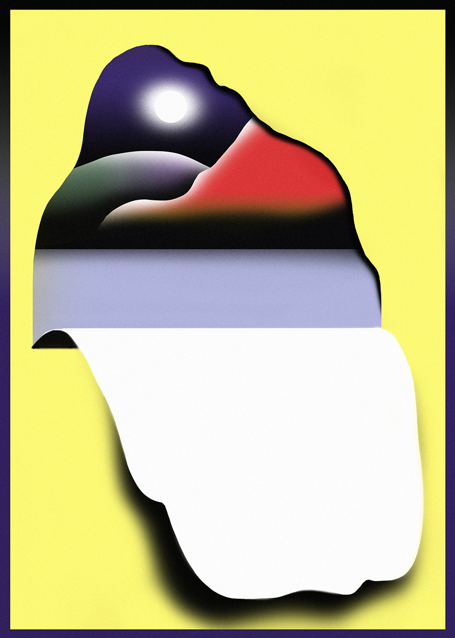
The image of a physical place, seen from above, gives a sense of wholeness, of truth. The bird’s eye view is not a natural way of looking at people or the world
There was no water where the map said there was; there was no ore there either. Two years later, the company was banned from selling shares. The use of the map was a wise business choice, though: maps, by design, look like reliable sources of information; they had long been used as arguments, propaganda, tools of persuasion. About 60 years earlier, a company called Jay Cooke & Co. sent a map to investors to try and sell bonds in the Northern Pacific Railroad. The map showed clear lines tracing the supposed route of the railroad, from Minneapolis and Duluth to Portland and Seattle — but none of the railroad had yet been constructed.
Maps have behaved throughout history as pieces of literature or devices of expression used to advance particular agendas. The image of a physical place, seen from above, gives a sense of wholeness, of truth. Maps have the power to give a physicality to places and things that do not exist, as with the maps of the Railroad and Death Valley: they made bad buys look solid and very real. The population of California at the turn of the century was less than two million, compared to the 40 million today; the development of the American West, a place that for most of the 19th century was not solid or real as far as most Americans could imagine or see, relied on maps that expressed aspirations, which included lies, in order to give Americans a picture of something that was being created, something that had to be willed into existence.
Maps are productive rather than simply informative creatures; they start dialogues and create identities. Historically, they have been used by centralized bodies, disseminating information to individuals — whether companies selling products or governments selling the idea of statehood. The internet takes maps and mapping practices from central bodies to individuals, but through this they remain totally detached from the geographical areas they supposedly represent, and invaluable tools for institutions to exercise power over people.
The map’s origins in the rise of the state are easily obscured. In his book Rethinking the Power of Maps, Denis Wood points out that for most of history, maps did not exist; but that from about the 17th century onwards, when they became common, they were defined as “a representation of a part of the earth’s surface.” This definition, he argues, naturalizes the map and its role in our society — it frames mapping ability as a natural or sometimes biological impulse. But, as he reminds us, “millions of Americans crossed the continent without maps, Genghis Khan and Charlemagne ruled without maps, Rome administered its empire without a map, pharaohs controlled Egypt without a map, the Bible was written without once referring to a map.” Landscapes were seen, observed, and talked about for the purpose of ruling and exploring: “Where talk serves, maps are rare,” he writes.
The map, then, does not fulfill an inherent need in us to orient ourselves with a bird’s eye view — and the bird’s eye view is not a natural way of looking at people or the world. Maps are used by the modern state to define and claim outside ownership of territories: the map came into existence out of a political agenda to root people to entities to which they would have to be loyal, but could not see. It narrativizes us and our surroundings, and makes them legible. “People create maps only when their social relations call for them,” Wood writes, “And the social relations that most insistently call for maps are those of the modern state.”
Benedict Anderson’s Imagined Communities identifies the map as one of three central “nation-building” artifacts, along with the census and the museum — institutions that enabled nationalist enthusiasm for a colonial state. In Southeast Asia, European countries used maps to legitimize otherwise illegitimate transfer of property and write inaccurate national histories of former colonies, like the “historical maps” in Siam which depicted the “geo-body” — unified, coherent nation-entities — as thousands of years older than the concept was in that region.
Boundary-stones and other physical ground markers that were understood only horizontally, as well as traditional maps that depicted and catered to the eye level and those who had an eye-level relationship with the space, slowly disappeared or were co-opted; traditional words krung and muang, which in Thai describe a collection of visible, disjointed population centers, were replaced with prathet, or “country” — a centralized entity with invisible boundaries. In this context, writes historian Thongchai Winichakul, “a map anticipated spacial reality,” rather than the other way around; the map “was a model for, rather than a model of, what it purported to represent…it had become a real instrument to concretize projections on the earth’s surface. A map was now necessary for the new administrative mechanisms and for the troops to back up their claims.”
Imperial states used maps as national logos that could be literally removed from the rest of the world and transplanted onto royal seals, letterheads, or decorations, without context. “Wholly detached from its geographic context … pure sign, no longer compass to the world,” Anderson writes. “Instantly recognizable, everywhere visible, the logo-map penetrated deep into the popular imagination.” This was the same imagery that the colonial state’s “local adversaries,” anticolonial nationalists, like the right-wing Hindu fundamentalist movement in India, responding to the British empire, also came to later use in its reactionary idea of nationhood — “as in an ominous prophetic dream,” Anderson writes.
Maps are very effective at manufacturing a sense of centralized identity where one otherwise does not exist: they link places to “things,” like citizenship and taxes. Arunachal Pradesh, for example, appears on Google Maps India as an Indian state, and on Google Maps China as Southern Tibet. With its Bangladesh border, India until recently shared about 160 enclaves, or territory within the other’s territory, whose residents have long had difficulty obtaining identity cards that they need in order to move through the arguably arbitrarily drawn concentric national borders. The most popular origin story for this incredibly complex enclave system is a drunken British colonial administrator who spilled ink on a map.
The “eye level” relationship between people and their immediate surroundings is at odds with the consumer identities that centralized entities are trying to create
Cartographer J. Brian Harley argued that the map was a fusion of the agency of the mapmaker and the mapmaker’s patron — there is a tension between the different interests of the craftsman and the statesman: one’s power is technical, while the other’s is political; one’s “distortion of map content” is unconscious, while the other is deliberate. These were both equally influential forces on the map, but because of their opposition, the authority of the map was diffused, “erasing authorship.” This ambiguity, this “modesty,” helped to give the map the appearance of a balanced, objective artifact. The map’s agency was made invisible — consequently, the map was naturalized as “a window on the world (instead of an argument about it),” as Denis Wood comments.“At the root of the map’s claim to objectivity lies its outrageous irresponsibility.”
Mapping as a colonial institution is one attempt to conjure a sense of collective identity — maps as advertisements are another version of the same project. Capitalism blurred the distinction between citizen, resident, and customer, giving very similar language to state and corporate agendas. Our value has historically been determined by how much we spend, whether on products or taxes or loyalty. The maps of Death Valley and the Northern Pacific Railroad were, among other examples from their time period, ways of making the virtues of products appear as clear and natural as the ideas of place they were attached to: California, New York City, America. P. J. Mode, a retired lawyer and map collector, called maps the most ostensibly credible of all mediums of communication. “Advertisers live and die for greater credibility,” he said in 2017, “and therefore they gravitate to the medium of cartography.”
In 1898 a map of Manhattan served as the backdrop for a totally unrelated advertisement for L. C. Bliss & Co.’s leather Regal Shoes, where one giant shoe was superimposed on the island. The recently completed Brooklyn Bridge is clearly visible, and was, according to Mode, the inspiration for several such advertisements during this time. A political advertisement from a few years earlier showed Richard Croker, leader of Tammany Hall, and Hugh McLaughlin, leader of the Democratic Party in Brooklyn, reaching across the East River to shake hands and forming a shape similar to the Brooklyn Bridge; the text compares them to two English monarchs and their “fixed system of despotic rule.” Such imagery would have been significant in the project of “branding” New York City, and the highly related project of establishing it as a politically legitimate and formidable city.
Mode remarked that the birds-eye view in general was a very popular aesthetic choice around this time: another advertisement, from 1897, employed this view of Manhattan to promote the “largest dealers in horses in the world.” The Fiss, Doerr, and Carroll Horse Company had been based in Kips Bay for the past 32 years. Until the rise of the automobile, they dominated the transportation market in New York City, and were careful to use the Manhattan skyline in their publicity to associate the commercial value of their product to the cultural value of the city. Carroll told a Printer’s Ink reporter that they planned to invest the contemporary equivalent of about $135,000 that year on “a map of Greater New York, together with pictures of the company’s buildings, and portraits of the firm’s members. This is said to be the most accurate map of Greater New York thus far published.”
Manhattan is, in many ways, an advertisement itself, its sexy hourglass figure the conduit to promote any number of products. Tobacco companies, for example, have used it extensively to equate the glamor of smoking with the glamor of New York. It is so all-pervasive, and removed from its geographical location, that in 2018 Chicago mayoral candidate Willie Wilson — possibly mistakenly — used it in a backdrop of one of his campaign ads. In their study of American symbols in Israeli advertising, scholars Anat First and Eli Avraham found that banks, retailers, and car companies, among others — all selling products that were specifically meant to be used in Israel — employed the Manhattan skyline far more frequently than that of other global cities, including Tel Aviv, “to create a sense of the vastness of monolithic America,” a unified and comprehensible whole.
From L. C. Bliss & Co to these contemporary tobacco or real estate or banking firms, New York’s history has been full of this entanglement of commodity and political entity. Maps created by colonial governments were in the business of creating political identities, while these advertisements reinforce them. But they are both the same kind of artifact, legitimizing the city by creating an omnipresent, memorable character; both coming from comparable, centralized entities in whose interest it is to alienate individuals from the physical relationship they have with their immediate surroundings — because this “eye level” relationship is at direct odds with the identities of consumer and national citizen that these entities are trying to create. The distinction between advertisement and product blur as does that between map and place.
In 2010, Facebook released a luminescent blue map that was generated by the connections made by the platform’s 500 million users. An intern at Facebook drew physical lines that corresponded to these coordinates; they created an image that looked startlingly like the world map. Mark Zuckerberg, by that point, had already described Facebook’s cartographic aspirations: “The idea isn’t that Facebook is one new community… it’s mapping out all the different communities that exist in the world already.” Our tendency to use our locations as a part of our practice of expressing ourselves online makes this ambitious project of Facebook’s entirely plausible.
The internet’s role in creating and disseminating maps has, to some extent, decentralized the nature of how they communicate. For the most part, maps are no longer overtly shared instruments assigned to us by a centralized authority, but rather individual instruments, seemingly springing up in moments of spontaneous creative expression. With apps like Google’s Tour Builder, we can create maps of our lives and travels, taking other people through our movement. We can pinpoint where specific events happened and integrate photos, videos, or text into sections of a story that are organized by location; everyone is the potential author of a Lonely Planet-like guide to a new city. On a smaller scale, Strava, a mapping app, allows us to track and map our daily life to create interactive “stories.” On Strava, every “walk” has a name, and a place on our personalized account. Apps like these make map a verb rather than a noun, in a new way; the map becomes a way of talking about a place, and by extension talking about ourselves. It is a way of narrativizing our lives, turning our daily life into stories about who we are by what we do.
We use maps to insert ourselves into spaces, and claim them
This kind of mapping is a sort of photographic negative of the mapping that Walter Benjamin did in his “Berlin Chronicle,” an autobiographical story using physical locations in his memory as the organizing principle for telling a story of his life. In both cases, the events of a life are plotted as points on a map. But where Benjamin uses detailed physical descriptions of these places in order to conjure up an image in his text, the mapping done through apps comes with readymade social-geographical context. A photo tagged “Central Park” or “Times Square” or “Brooklyn Bridge” — Instagram’s most popular locations in New York last year — communicate the idea of a place more than a physical location. The personalized ways in which locations are used on social media make a city both more disconnected and more legible to the outsider at the same time: less and less relevant as navigational information, but increasingly efficient at communicating personalities, lives, individual narrations, identities.
This practice of mapping assigns physical places with social capital and a social function. Place becomes absorbed into person; it is a function of person, rather than the other way around. Sixteenth-century rulers would hang maps in their palaces to represent the power of the cities they ruled; we, too, integrate our personae with the spaces we occupy, and in some ways own, because we have written these places onto maps. Knowing the actual place becomes irrelevant compared with knowing it in the context of a personal narrative, which requires knowing the place’s social value. We use maps to insert ourselves into spaces, and claim them.
It would seem as though we have co-opted the impulse to narrativize our existence from the very means that institutions of power have used on us for centuries. But these mapping technologies require the individual to first be packaged into a consumable product, which can be equally totalizing: we are living under pre-anticipated conditions of our cities, and embodying the self that is required for the products we make. We mirror our shadows.
In the year or so before I moved to New York, I suddenly found my Instagram feed crowded with people who had recently moved to Brooklyn, and were extremely aware of it and intentional about it. In the way that any voyeuristic social media platform allows you to live through other people, I developed, from a different country and very different context, a strange intimacy with the places that these almost-total Brooklyn strangers on my feed frequented. I learned immediately that one says one lives in Brooklyn and not in New York City even when talking to someone who does not live in New York City. I learned when something is a “Bushwick thing,” even though I had spent all of one hour in Bushwick in my life.
Baudrillard called this kind of process “a real without origin or reality: a hyperreal,” which is what Brooklyn was to me for many years, and sometimes still is, even though I live here now. I am as surrounded by Brooklyn’s online persona as I am by its fragmented, chaotic physicality. My view of graffiti artist Gadse’s omnipresent work from the J train is superimposed on the T-shirt I saw on an urban explorer Instagram star once, declaring, This way to Brooklyn #JtrainOnly. The Monday.com subway ad making fun of Bushwick lofts (where, among parks and subways, “pest control” is in progress), and the merchandise describing the #BrooklynHustle on the rapidly gentrifying sidewalks of Crown Heights, create a complicated personality for Brooklyn: one that both reflects the exclusivity and displacement that now characterizes much of Brooklyn’s new, largely white population, while being self-conscious, ironic, and often flippant about it.
This online persona does not, and is not trying to, correspond to the physical realities of Brooklyn, but it is made to stand in for it. This social media form of mapping, then, creates personality and imposes a reality onto spaces that are inherently consumerist, in the same way that authoritarian imposition, both state and corporate, once did for the same locations. As Thongchai Winichakul identified, this practice does not relay a physical reality; it precedes it. Personal mapping creates a model for Brooklyn, rather than a model of it.
In this way, consumerization becomes the new totalitarianism. Contemporary mapping introduces the project of individualism to what was earlier largely a project of nationalism or collectivism. Social media mapping practices diffuse some of the power held by corporate or political entities to the level of individuals — who carry out the same agenda by claiming and redefining space according to a personal sense of its meaning, using the same systems that corporate and national projects did for the same purpose. They wield influence over the people and landscapes around them; they create identities that can be sold, whether through merchandise or in conversation or by advertising agencies; they make money, take up space, dominate discourse.
They deal, essentially, in products — legible, lucrative products. In this way, people who update their Snap Map location or their Strava account or geotag their Instagram photos, because they feel obliged to be seen, are using the same modes of self-dissemination as Fiss, Doerr, and Carroll, or European empires: under the influence of corporate and national ideas of the self. National or corporate institutions instill monetary or political agendas in maps; the map-making ability of social media creates the social equivalent.
New York has a history of renaming unpopular neighborhoods to attract a more “refined” population (Harlem to Morningside Heights and now “SoHa,” Sunset Park to South Slope). At the other extreme, Summerhill Café in Crown Heights tried to attract customers last year with its “Instagrammable” wall riddled with fake bullet holes. Brooklyn’s gentrification is and encourages a progressive new kind of colonialism: the narrativizing of Brooklyn as a product to be consumed and incorporated into the way we talk about ourselves and move through the world.
That is why “Bushwick” is no longer just a neighborhood but also a movie about some sort of apocalypse, as well as an $81 candle scent — titled “McKibbin + Bogart 03” and replicating the “wood, oil, paint thinner, incense, ICR vs. Deth Killers of Bushwick.” More accurately, it replicates the blocks around the McKibbin and Bogart Lofts, a very specific area that began attracting new, young residents fairly early, marketing itself as East Williamsburg, because white people did not want to live in Bushwick.
To subsume this history into the word “Bushwick” as a descriptor of the scents surrounding artist lofts, and lump that together with a casual reference to the neighborhood’s history of violence and the commodities that have come out of it, is the sort of race and class appropriation that can only be said to succeed under the hegemonic influence of capitalism and the state — a kind of blackface that goes unquestioned on a daily basis in the media language we speak. This narrativization is part of the legacy of colonial projects imposing national identity through visual means to override the past character of a place.
Mark Fisher wrote in Capitalist Realism of a general public that has become simply “an aggregation of individuals and their interests.” This condition is the reason why there is a lack of public general will, which the state should ideally be subordinated to. Ours is the world Fisher was describing: a breakdown of the difference between “centralized” and “decentralized,” a world where decentralized practices can easily become co-opted into the same narrative methods as centralized ones, of inscription and appropriation of landscape and culture. Under capital, “all that is real is the individual,” but the individual can never escape the influence of capital, which is the driving force behind seemingly disconnected and independent symptoms in society. It was essential to Fisher to make this distinction in order to escape it.
In 1949, shortly after the publication of 1984, Aldous Huxley wrote a letter to George Orwell thanking him for a copy of the new book. It was a fine book, he said, but, “May I speak instead of the thing with which the book deals — the ultimate revolution?”
The totalitarianism at the end of the world, Huxley sensed, would not look like what one expected it to look like. It would be far too pleasant, far more insidious. “Within the next generation I believe that the world’s rulers will discover that infant conditioning and narco-hypnosis are more efficient, as instruments of government, than clubs and prisons, and that the lust for power can be just as completely satisfied by suggesting people into loving their servitude as by flogging and kicking them into obedience,” he wrote. “I feel that the nightmare of 1984 is destined to modulate into the nightmare of a world having more resemblance to that which I imagined in Brave New World.”
Huxley is perfectly describing capitalism here, and it is to his point — and to Fisher’s, about capitalist realism — that we don’t have a term for a “Huxleyan” world the way we have for an Orwellian one. The reality of the brave new world is too perfunctory to merit such a dramatic term, but this is exactly the kind of language that Fisher is trying to bring about. Without the denormalization of the influence of capital, there cannot wholly be an animosity between the “centralized” and the “decentralized.” With this animosity, though, there can emerge a public with a set of collective identities that escape the state. And perhaps the state can be defined by the individual; the individual defined by her landscape, not only mapping her world but being mapped by it, too.