
In 2007, before Chrome, Android, and Docs, Google announced that it had already photographed nearly every street in five large cities, and intended to photograph every road in the world. A little over 10 years later, this braggadocious threat is well on its way to being realized: Google has successfully captured about half the world’s streets.
The technology that makes Street View possible is a bit of software that converts video into a series of stitched-together photos. The result is an incredibly long, intricately connected series of photos that are more like the tunnels in an ant farm than anything resembling a map. These pictures put the viewer in a distinctly cyborgian position, at average human height but in the center of the road, recapturing a viewing angle that was only possible before the car. Even though the images are clearly meant to convey information over affect, they are still capable of producing a mood: To look at your childhood home or your workplace in Street View is to adopt the cold stare of a stranger. Being “Ogled by Google,” as the Hartford Courant called it when the service was first announced, is at once disturbing and affirming.
The near-ubiquity of Street View means that exclusion from the map is reserved for only the most powerful and the most forgotten. What is included and what isn’t — private islands, gated communities, prisons, and rural poverty — is a bell curve with social power as its horizontal axis. The vertical axis, let’s just call it visibility, trends with other services of the digital age: ride hailing, food delivery, and cheap next-day shipping. To be inaccessible can be a redoubt from a hectic world or a violent isolation from our fellow humans. Street View provides an index of this relationship between geography, visibility, and digitality.
Street View’s existence seems to literally argue what the French philosopher Baudrillard meant metaphorically when he wrote in Simulacra and Simulation: “The territory no longer precedes the map, nor does it survive it. It is nevertheless the map that precedes the territory — precession of simulacra — that engenders the territory.” Here he was describing the way symbols and images can outlive or transcend that which they were supposed to depict. As more technologies and social norms accrete around Street View images it will become increasingly difficult to understand or even visit places that are not reproduced in Google’s servers. Researchers are already looking to use Street View photos to “audit neighborhood environments” and score them on everything from pedestrian safety to social disorder. The street view photo, for the purposes of assessing neighborhood health and quality of life, may soon be more real (or at least more relevant) to funding agencies, rating systems, and government regulators than the buildings and people themselves. All this with no democratic mechanism for requesting, contesting, or evaluating Street View cars and their cameras.
The editors of Real Life are soliciting essays for a new column which will use Street View to tell stories about people and places. We are looking for stories that begin with a Street View screenshot and end with an argument about living with technology: how built form is connected to memory. We’d love essays that consider a specific time and place as depicted on the platform using the under-appreciated time-shifting feature that lets you see previous Street View shots.
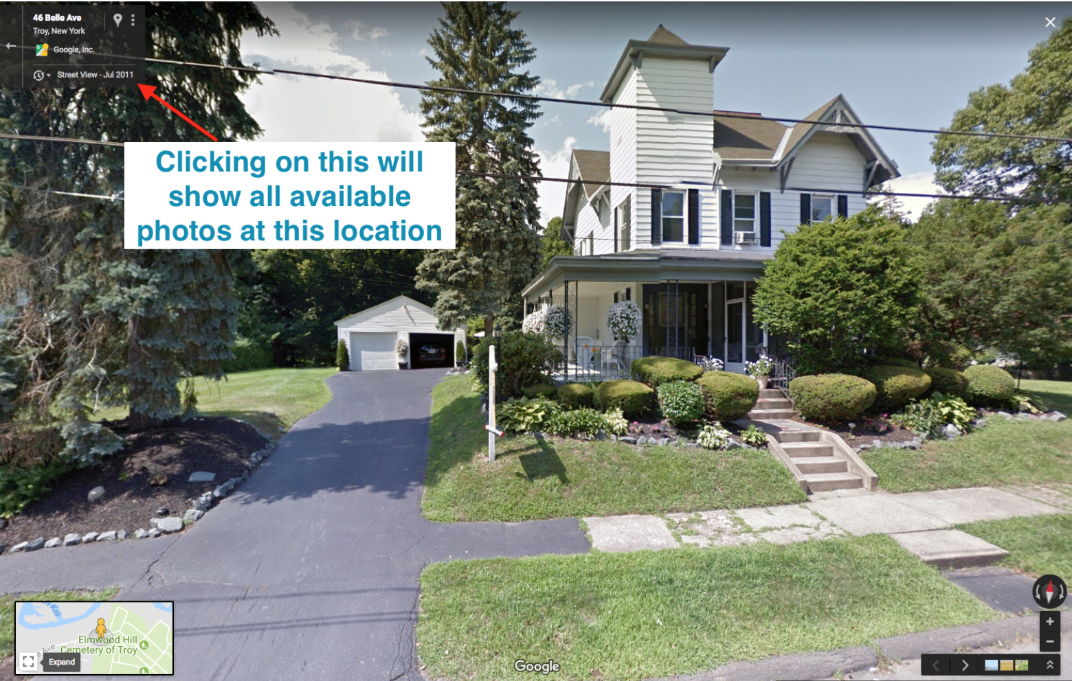
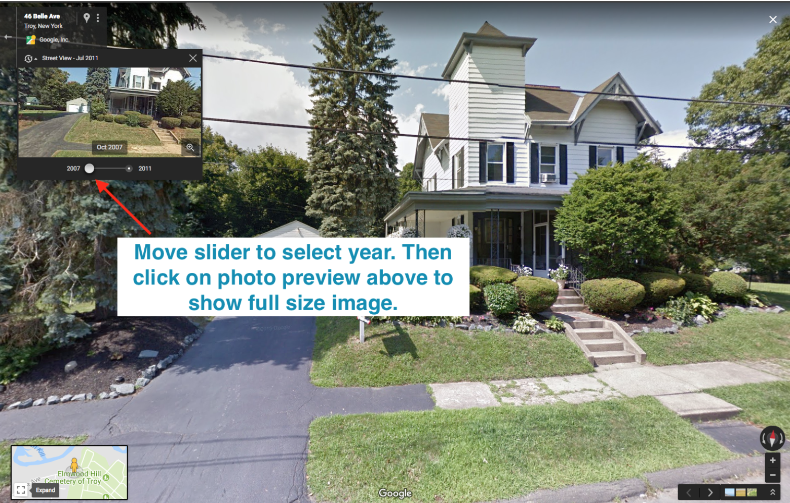
Why did a house disappear? Why did a road widen? How has a neighborhood changed? What keeps Street View from seeing past that intersection?
We welcome submissions on:
Real Life
August 23, 2018